
JR Geo: Mapping Innovation and Smart Geospatial Solutions AI
JR Geo is an innovative geospatial technology platform designed to transform the way organizations collect, analyze, and utilize location-based data. By combining advanced mapping tools with artificial intelligence, JR Geo helps users gain deeper insights into geographic information. The platform supports a wide range of industries, including urban planning, transportation, agriculture, environmental management, and business intelligence. Its ability to process large datasets and present them through interactive maps makes it a valuable solution for modern decision-making.
The Vision Behind the Platform
The vision of JR Geo is to make geospatial intelligence more accessible, accurate, and actionable. As the world generates increasing amounts of location-based data, organizations need smarter ways to interpret information. JR Geo aims to bridge the gap between complex geographic datasets and practical business applications. By integrating AI-driven technologies, the platform empowers users to uncover patterns, identify opportunities, and make informed decisions with confidence.
The Evolution of Geospatial Technology
From Traditional Mapping to AI-Powered Solutions
Geospatial technology has evolved significantly over the years. Traditional mapping methods relied heavily on manual data collection, paper maps, and static geographic records. While these tools were effective for their time, they often lacked flexibility and real-time capabilities. The introduction of digital mapping systems revolutionized the industry by enabling faster data processing and visualization.
Today, artificial intelligence has taken geospatial technology to the next level. AI-powered platforms such as JR Geo can analyze vast amounts of spatial data, identify trends, and generate valuable insights automatically. This shift from traditional mapping to intelligent systems has improved efficiency, accuracy, and scalability across numerous industries.
The Growing Importance of Geospatial Intelligence
Geospatial intelligence has become an essential component of modern operations. Businesses, governments, and organizations increasingly rely on geographic data to understand market trends, optimize resources, and improve planning strategies. Location intelligence helps decision-makers identify patterns that might otherwise remain hidden within large datasets.
As global challenges become more complex, the demand for accurate spatial information continues to grow. From monitoring environmental changes to managing transportation networks, geospatial intelligence plays a critical role in solving real-world problems. JR Geo contributes to this growing field by providing advanced tools that simplify data analysis and improve strategic planning.
You might also like: Technology Shapes Our Daily Lives
Key Features of JR Geo
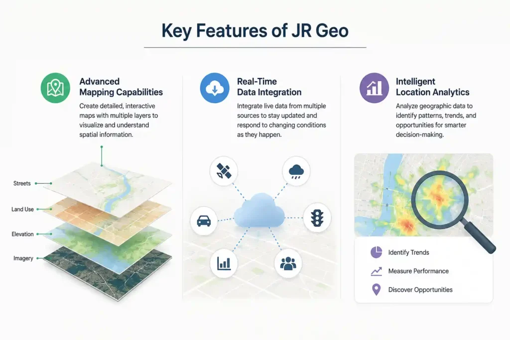
Advanced Mapping Capabilities
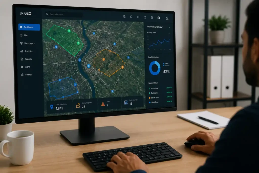
One of the standout features of JR Geo is its advanced mapping functionality. The platform enables users to create highly detailed and interactive maps that display multiple layers of information. These maps help organizations visualize geographic relationships and better understand spatial patterns. Advanced mapping tools also improve communication by presenting complex data in an easy-to-understand format.
Real-Time Data Integration
Modern decision-making requires access to current information. JR Geo supports real-time data integration, allowing users to monitor changing conditions as they occur. Whether tracking transportation routes, environmental conditions, or business activities, real-time updates help organizations respond quickly to emerging situations. This capability improves operational efficiency and enhances overall situational awareness.
Intelligent Location Analytics
JR Geo goes beyond traditional mapping by offering intelligent location analytics. The platform can examine geographic data to identify trends, relationships, and opportunities. These insights enable organizations to make smarter decisions based on evidence rather than assumptions. Intelligent analytics also help businesses optimize operations, reduce costs, and improve long-term planning.
How JR Geo Uses Artificial Intelligence
AI-Driven Data Processing
Artificial intelligence is a core component of JR Geo’s functionality. The platform uses AI algorithms to process large volumes of geographic data quickly and accurately. Automated analysis reduces the time required to interpret information while minimizing the risk of human error. This allows users to focus on strategic decision-making rather than manual data management.
Predictive Geographic Insights
Predictive analytics is another powerful feature of JR Geo. By analyzing historical and current data, AI models can forecast future geographic trends and potential outcomes. These predictive insights help organizations prepare for changes, manage risks, and identify new opportunities. The ability to anticipate future scenarios provides a significant competitive advantage in a data-driven world.
Automated Decision Support
JR Geo also delivers automated decision support through intelligent recommendations and data-driven guidance. AI systems evaluate multiple variables and present actionable insights that assist users in making informed choices. This automation improves efficiency, enhances accuracy, and supports better outcomes across various applications. As artificial intelligence continues to evolve, platforms like JR Geo are shaping the future of geospatial innovation and location intelligence.
Applications of JR Geo Across Industries
Urban Planning and Smart Cities
JR Geo plays an important role in urban planning and smart city development by helping governments and planners understand how cities function. Through advanced geospatial analysis, the platform provides valuable insights into population growth, land use, infrastructure development, and public service distribution. Urban planners can use these insights to design more efficient transportation systems, improve zoning strategies, and allocate resources effectively. By integrating real-time geographic data, JR Geo supports smarter decisions that enhance sustainability, reduce congestion, and improve the quality of life for residents. As cities continue to expand, geospatial intelligence becomes increasingly important for creating connected and resilient urban environments.
Agriculture and Environmental Monitoring
Agriculture and environmental management benefit significantly from the capabilities offered by JR Geo. Farmers can use location-based data to monitor crop conditions, evaluate soil health, and optimize irrigation practices. This enables more efficient resource utilization while improving productivity and reducing operational costs. Environmental agencies also rely on geospatial technology to monitor ecosystems, track climate-related changes, and identify potential environmental risks. By providing accurate geographic insights, JR Geo helps organizations make informed decisions that support sustainable agriculture and environmental conservation efforts.
Transportation and Logistics
Transportation and logistics companies require precise location intelligence to manage operations efficiently. JR Geo assists organizations by offering route optimization, fleet tracking, and geographic analysis tools that improve overall performance. Real-time visibility into transportation networks allows businesses to reduce delays, lower fuel consumption, and improve customer satisfaction. Logistics managers can analyze traffic patterns, identify bottlenecks, and make adjustments to maintain efficient supply chain operations. These capabilities make JR Geo a valuable solution for organizations seeking greater operational control and reliability.
You might also like: Concept to Product: Role of a Custom AI Hardware Design Agency
Benefits of Using JR Geo
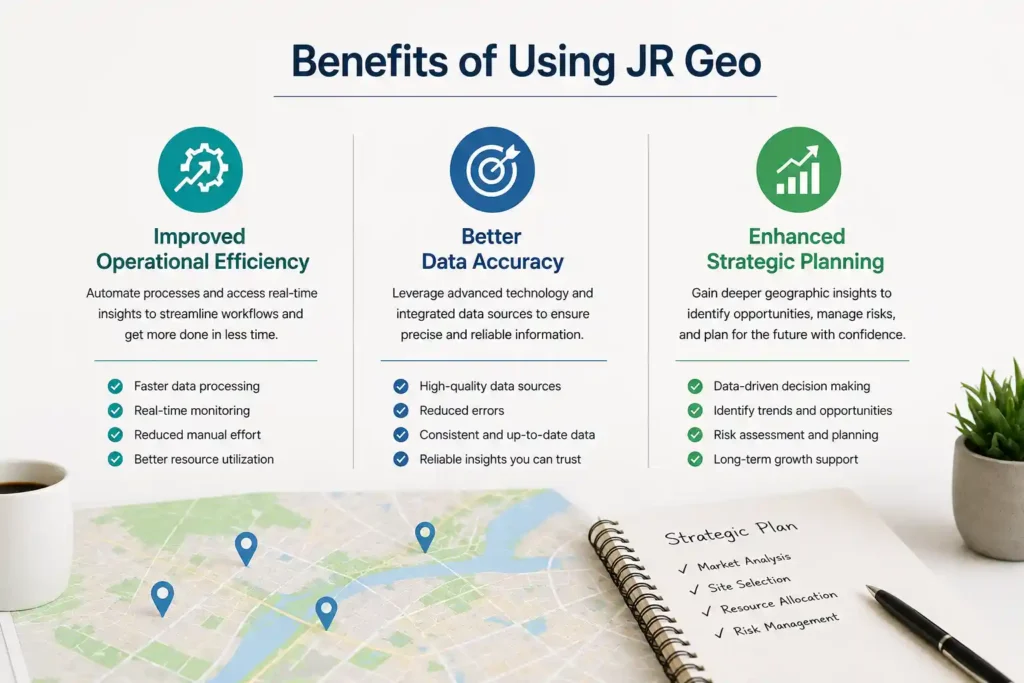
Improved Operational Efficiency
One of the primary advantages of JR Geo is its ability to improve operational efficiency. By automating data collection, analysis, and visualization processes, the platform reduces manual workloads and accelerates decision-making. Organizations can quickly access critical geographic information and respond to changing conditions without delays. This streamlined approach saves time, minimizes errors, and enhances productivity across multiple business functions.
Better Data Accuracy
Accurate information is essential for effective decision-making, and JR Geo is designed to provide reliable geographic data. The platform integrates information from multiple sources and applies advanced processing techniques to ensure consistency and precision. Accurate data helps organizations avoid costly mistakes, improve forecasting, and develop more effective strategies. Whether used for planning, monitoring, or analysis, reliable geospatial information contributes to stronger outcomes and greater confidence in decision-making.
Enhanced Strategic Planning
Strategic planning requires a clear understanding of both current conditions and future possibilities. JR Geo supports this process by transforming complex geographic data into actionable insights. Organizations can evaluate trends, identify opportunities, and assess risks with greater clarity. These capabilities allow decision-makers to create informed strategies that align with long-term goals. Enhanced planning not only improves organizational performance but also increases adaptability in rapidly changing environments.
JR Geo and Real-Time Mapping Solutions
Live Location Tracking
Live location tracking is one of the most practical features offered by JR Geo. Organizations can monitor assets, vehicles, personnel, and operations in real time through interactive mapping tools. This immediate visibility allows businesses to respond quickly to unexpected events and maintain greater control over daily activities. Real-time tracking also enhances safety, improves coordination, and supports more efficient resource allocation across various industries.
Dynamic Geographic Visualization
JR Geo transforms raw geographic data into dynamic visual representations that are easy to interpret. Interactive maps, layered datasets, and customizable dashboards provide users with a comprehensive view of spatial information. Dynamic visualization helps decision-makers identify patterns, relationships, and emerging trends that may not be apparent through traditional reports. This visual approach improves communication and supports faster, more informed decision-making.
Data Security and Reliability in JR Geo
Secure Data Management
Protecting sensitive information is a critical priority for modern organizations. JR Geo incorporates secure data management practices to safeguard geographic information from unauthorized access and potential threats. Advanced security measures help maintain data integrity while ensuring that authorized users can access information when needed. Strong security practices increase trust and support reliable operations.
Compliance and Privacy Standards
JR Geo is designed with compliance and privacy considerations in mind. Organizations can manage geographic data while adhering to relevant regulations and industry standards. This commitment to privacy helps reduce legal risks and ensures responsible handling of sensitive information.
You might also like: Best AI Tools for Small Businesses
How Businesses Can Leverage JR Geo
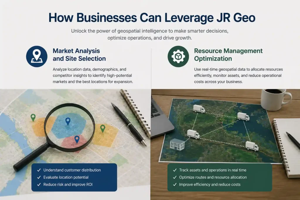
Market Analysis and Site Selection
Businesses can use JR Geo to evaluate markets, identify customer trends, and select strategic locations for expansion. Geographic insights reveal opportunities that support growth and competitive advantage.
Resource Management Optimization
JR Geo enables organizations to allocate resources more effectively by analyzing geographic conditions and operational requirements. Better resource management reduces costs, improves productivity, and supports sustainable business performance.
JR Geo Compared to Traditional GIS Platforms
Key Differences
Traditional Geographic Information System (GIS) platforms have long been used for mapping, spatial analysis, and geographic data management. While these systems remain valuable, they often require extensive manual processing and specialized expertise. JR Geo takes a more modern approach by combining geospatial technology with artificial intelligence to simplify data interpretation and improve usability. Unlike conventional GIS solutions that primarily focus on storing and displaying geographic information, JR Geo emphasizes automation, real-time analysis, and predictive insights. This allows users to move beyond static maps and gain actionable intelligence from complex datasets. The result is a more efficient platform capable of supporting faster and more informed decision-making.
Advantages of AI Integration
Artificial intelligence is one of the defining features that sets JR Geo apart from traditional GIS platforms. It can identify patterns, detect anomalies, and generate recommendations based on geographic trends. This capability reduces the burden on users while improving the quality of insights. AI integration also supports predictive analytics, helping organizations anticipate future developments rather than simply reacting to current conditions. By combining geospatial intelligence with machine learning, JR Geo delivers a more dynamic and forward-looking approach to geographic analysis.
Future Innovations Expected from JR Geo
Emerging AI Technologies
As artificial intelligence continues to evolve, JR Geo is expected to benefit from new technological advancements that enhance its capabilities. Emerging AI technologies such as deep learning, natural language processing, and advanced computer vision could further improve how geographic data is collected, analyzed, and interpreted. These innovations may allow users to process increasingly complex datasets while gaining more accurate and meaningful insights. Future AI enhancements will strengthen automation and improve the overall efficiency of geospatial workflows.
Expansion of Geospatial Capabilities
Improved integration with Internet of Things devices, satellite imagery, and real-time sensors could provide users with richer and more comprehensive data sources. Enhanced visualization tools also make geographic information easier to understand and communicate. As technology advances, JR Geo is positioned to become an even more powerful platform for organizations seeking location-based intelligence and strategic decision support.
You might also like: Smart Home Essentials for Modern Living
Challenges and Limitations of Geospatial AI
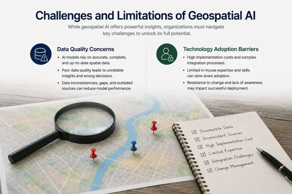
Data Quality Concerns
Despite its many advantages, geospatial AI is not without challenges. One of the most significant concerns involves data quality. AI systems rely on accurate and complete information to generate reliable results. If geographic datasets contain errors, outdated records, or inconsistencies, the quality of insights may be affected. Organizations must ensure that data is properly collected, verified, and maintained to maximize the effectiveness of geospatial AI solutions. Strong data governance practices remain essential for achieving dependable outcomes.
Technology Adoption Barriers
Another challenge is the adoption of advanced geospatial technologies. Some organizations may face difficulties due to limited technical expertise, budget constraints, or resistance to change. Implementing AI-powered systems often requires training, infrastructure investments, and process adjustments. These factors can slow adoption and create barriers for businesses that are unfamiliar with geospatial intelligence. However, as platforms become more user-friendly and accessible, these challenges are expected to decrease over time.
Why JR Geo Is Shaping the Future of Spatial Intelligence
Industry Impact
JR Geo is helping redefine how industries use geographic information by transforming raw data into valuable intelligence. Organizations across sectors such as transportation, agriculture, urban planning, environmental management, and logistics can use the platform to improve efficiency and make more informed decisions. Its ability to combine real-time data with advanced analytics enables businesses and governments to respond more effectively to changing conditions. This broad industry impact highlights the growing importance of intelligent geospatial solutions.
Long-Term Growth Potential
The demand for spatial intelligence is expected to grow as organizations increasingly rely on data-driven strategies. As businesses seek more accurate forecasting, improved operational visibility, and better decision-making tools, the value of AI-powered geospatial platforms will continue to rise. This creates strong long-term growth potential for solutions that can transform geographic data into actionable insights.
Frequently Asked Questions (FAQs)
What is JR Geo used for?
JR Geo is used for mapping, spatial analysis, geographic intelligence, and data-driven decision-making across multiple industries.
How does JR Geo utilize AI technology?
It uses artificial intelligence to automate data processing, identify patterns, generate insights, and support predictive analytics.
Which industries benefit most from JR Geo?
Industries such as agriculture, transportation, logistics, environmental management, and urban planning benefit significantly from its capabilities.
Is JR Geo suitable for small businesses?
Yes, businesses of different sizes can use JR Geo to improve planning, efficiency, and location-based decision-making.
What makes JR Geo different from traditional GIS tools?
JR Geo combines GIS functionality with AI-powered automation, predictive analytics, and real-time intelligence.
Conclusion
JR Geo represents the next generation of geospatial technology by combining artificial intelligence with advanced mapping and analytics. Its innovative capabilities help organizations gain deeper insights, improve efficiency, and make smarter decisions. As spatial intelligence continues to evolve, JR Geo is expected to play a significant role in shaping the future of data-driven geographic solutions worldwide.